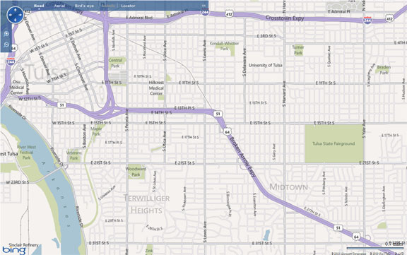
The Tulsa Grid – Easy Directions to find your way around in Tulsa
Sure most of us have a GPS, but understanding Tulsa’s grid will better help you find your way around in Tulsa.
System of numbering: Main Street is the dividing line for east and west. Admiral Boulevard is the dividing line for north and south. Numbered streets run east and west beginning one block south of Admiral.
Numbered streets, such as 11th Street, 21st Street, 31st Street, and so on, are one mile apart. The one exception is 15th Street, also known as “Cherry Street,” which is, of course between 11th and 21st Streets.
Named streets from west to east are: Riverside, Peoria, Lewis, Harvard, Yale, Sheridan, Memorial, Mingo and Garnett. These are also one mile apart. The exception to this is Utica Avenue which is halfway between Peoria and Lewis.

Riverside Drive: 900 block west
Main Street: dividing line for streets running east and west
Peoria Avenue: 1300 block east
Utica Avenue: 1700 block east
Lewis Avenue: 2400 block east
Harvard Avenue: 3300 block east
Yale Avenue: 4900 block east
Sheridan Road: 6500 block east
Memorial Drive: 8100 block east
Mingo Road: 9700 block east
Garnett Road: 11300 block east
If you don’t have a compass, remember this silly saying, “the WIVER is west.” Of course I’m referring to the Arkansas RIVER! If you can figure out where you are in relation to the river, this will help you get your bearings.
Downtown Tulsa is a similar grid but different named streets. I’ll save that for a separate blog post so that I don’t confuse you!
If you are relocating to Tulsa, we welcome you and hope this will help you to find Tulsa a little easier to navigate! Our expressways also make Tulsa travel easy, but stick to the side streets until you know your way around!

